
Aviation English, established by the International Civil Aviation Organization (ICAO) in 1951, is the foundation of operational efficiency and safety. More importantly, it significantly relies on abbreviations, such as ATIS, to ensure clear, concise communication between pilots, crew members, and air traffic controllers in real time.
Understanding aviation terminology and abbreviations isn’t solely about streamlining operations. It’s also about reducing errors, navigating complex airspace environments, and standardizing industry-specific procedures. Automatic Terminal Information Service (ATIS), in particular, is a vital component of both successful travel and consistency.
In this guide, we’re exploring what ATIS means in aviation and why it’s remained a successful tool for decades. Additionally, we will discuss how ATIS works, what level of aeronautical information it provides, and why it’s essential in private aviation.
At JetBed, we understand the value of proper rest for those on flights. To exemplify this, our patented in-flight sleep solution combines precision engineering with artisanal craftsmanship. Made entirely in the USA and reflecting the highest standards of durability, each custom-fit JetBed has become the standard for hotel-quality rest at 40,000 feet.

What Is ATIS in Aviation? Definition, Purpose, and How It Works
Automatic Terminal Information Service (ATIS) is a continuous broadcast system that provides pilots with essential aeronautical information for departing and arriving aircraft. While not strictly limited to high-traffic airports, ATIS effectively reduces radio congestion and the workload for air traffic controllers.
It does so by providing pilots with a continuous, updated, pre-recorded broadcast of critical airport and weather information before they communicate directly with air traffic controllers. Relevant information often includes current sky conditions, temperature, runway availability, and any operational advisories.
Moreover, each ATIS message is labeled with a phonetic letter (Alpha, Bravo, Charlie, etc.) using the NATO/ICAO phonetic alphabet. Once they receive the update, pilots can then verify with controllers that they are operating with relevant, recent weather observations and airport data.
Ultimately, each ATIS broadcast productively distributes standardized, real-time updates. This, in turn, mitigates the need for controllers to communicate with every incoming or departing aircraft. Having been in use for several decades, this automated system remains a cornerstone of modern aviation operations.
For additional context regarding standardized aviation abbreviations, review “What Is a VORTAC in Aviation?”
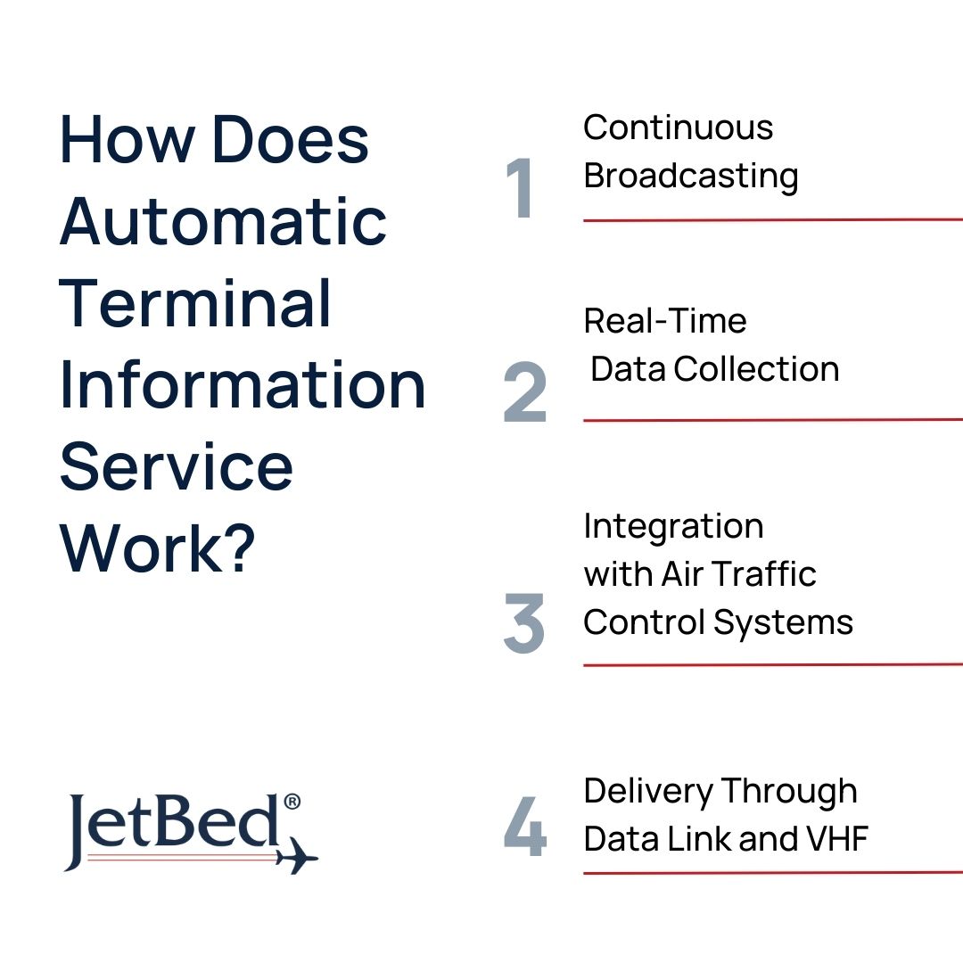
How Does Automatic Terminal Information Service Work?
Continuous Broadcasting
ATIS operates as a continuous broadcast repeating the same pre-recorded message until relevant conditions change. Additionally, ATIS transmitters offer a service volume of 20–60 nautical miles from an airport, extending to approximately 25,000 above ground level.
As a result, pilots can listen whenever they are within range of the transmitter—often prior to arrival or departure. As a procedure, however, pilots will listen to current ATIS updates before contacting air traffic controllers.
For additional context, review our guide: “What Does ATCM Stand for in Aviation?”
Real-Time Data Collection
Real-time consistency is a vital aspect in modern aviation. To verify data integrity, ATIS pulls information from systems including the Automated Surface Observing System (ASOS), Automated Weather Sensor System (AWSS), and manual inputs from air traffic controllers.
As mentioned previously, the consistent updates reduce air traffic controller workload and frequency congestion. Beyond that, however, ATIS updates hourly—or when significant changes occur—ensuring pilots have the most up-to-date report possible.
Integration with Air Traffic Control Systems
ATIS transmission is independent of active tower communications, meaning it operates on its own data channel. However, it fully integrates with broader Air Traffic Control (ATC) systems to improve safety and reduce the likelihood of miscommunication.
For example, pilots will tune in to automated messages to receive information regarding the weather report. They will then report phonetic letters to ATC upon arriving within a reasonable distance of the towers. This coordination ensures situational awareness and streamlines otherwise congested operations.
Delivery Through Data Link and VHF
Pilots can access modern ATIS messages via data link (D-ATIS) or VHF Voice Broadcast (Voice-ATIS).
Voice-ATIS, the standard in ATIS communication, is a continuous, spoken report on a VHF frequency. VHF, or Very High Frequency, provides clear, reliable transmission between aircraft and ground stations—a concept previously discussed in “What Is VOR in Aviation?” Data link systems are digital formats that allow pilots to review ATIS broadcasts as text on cockpit displays.
While D-ATIS offers additional convenience and reduced cockpit workload, Voice-ATIS remains universally accessible. Both systems coexist, giving flight crews flexibility in how they receive critical information.

Information Provided By ATIS in Aviation
Wind Direction and Velocity
Weather information is critical for ensuring flight safety and operational efficiency. Helping pilots ensure optimal conditions, ATIS reports wind direction and velocity on a general hour broadcast. More specifically, wind direction is provided in degrees magnetic, while speed is provided in knots. This system allows pilots to plan accordingly before contacting ATC.
For further context, visit our guide: “What Is Dead Reckoning in Aviation?”
Visibility
Generally, pilots determine visibility using various factors, including ASOS, visual separation, and, ultimately, ATIS. This system routinely reports visibility factors, indicating how far pilots can safely see along the runway and surrounding airspace. Generally, ATIS updates weather information hourly—unless visibility changes significantly.
Sky Conditions
Along with wind direction and visibility, ATIS also reports sky conditions, including cloud coverage, cloud layers, and ceiling height. If the ceiling is above 5,000 feet and visibility is more than 5 statute miles, however, ATIS broadcasts may omit this report as it is considered “better than VFR.”
We discuss disruptive cloud coverage in our post, “Can Planes Fly in Thunderstorms?”
Temperature and Dew-Point
The temperature and dew-point spread is an essential factor in determining humidity levels, which ultimately impact aircraft performance, density altitude, and engine performance. In addition to the dew-point altimeter, pilots rely on ATIS for information about fog, icing, and condensation-related concerns.
Altimeter Settings
ATIS broadcasts the current local barometric pressure, also known as the altimeter setting. This knowledge enables pilots to operate confidently with regard to terrain clearance, obstacle avoidance, and appropriate virtual separation. Even minor discrepancies can lead to significant errors, making this ATIS information vital to safety and consistency.
If you’re interested in learning more, visit our guide, “How to Read an Altimeter: Types, Instructions, and More.”
Active Runways
Runway availability is constantly fluctuating due to factors such as maintenance, safety, and weather. While seemingly complex, ATIS simplifies any confusion by alerting pilots of runways currently in use for both departure and arrival. This includes adjusted runway length, temporary closures, and any additional limitations that may affect operations.
For curious passengers or those within the aviation community, read “Average Runway Length” for further context.
Available Approach Types
Whether aircraft are flown visually or via instruments determines the approach currently in use at the airport. As a result, ATIS informs pilots of active, in-use, or expected approach types based on weather, equipment outages, or runway conditions. Early awareness supports safer, smoother arrivals.
Notices to Air Missions (NOTAMs)
Notices to Air Missions (NOTAMS) are time-critical alerts regarding changes or hazards in the airspace, at airport, or in the navigation system. ATIS often includes information relevant to current abnormal operations, ensuring pilots receive updates before landing or entering the controlled airspace.
Density Altitude (If Applicable)
As mentioned previously, density altitude signifies how “heavy” or “thin” the air feels, which ultimately impacts engine power and aircraft performance. As a result, pilots must keep a close eye, particularly during takeoff and landing. ATIS does not always provide exact altitudes unless flying at high temperatures or high elevations.
ATIS Aviation Example
Below are simplified examples of how ATIS broadcasts may appear in practice. While exact wording varies by airport, the structure remains the same:
- “Los Angeles International Airport ATIS Information Bravo. Time 1653 Zulu.”
- “Wind two-six-zero at eight. Visibility one-zero. Few clouds at two-zero-zero-zero.”
- “Advise on initial contact if you have Information Bravo.”
- “Departing and landing runways 25L and 25R.”
- “Warning, Runway Two-Five has been shortened, nine thousand six hundred and twenty feet available.”
- “Temperature one-eight, dew point one-twelve.”
Each ATIS message is concise, standardized, and made to be understood quickly—whether pilots receive it digitally or over the radio.
ATIS plays a critical role in maintaining safety, efficiency, and predictability across global aviation systems.
In aviation, minor details matter. And in modern operations, pilots have the advanced tools they need, such as ATIS, to maintain safe, efficient operations. By delivering real-time, standardized data, ATIS supports seamless flights, smooth coordination, and high efficiency across the industry.
Private flights are the most convenient, comfortable way to travel—especially when you fly with JetBed. We created what no other in-flight sleep solution can offer: a perfectly uniform, flat surface with no grooves or pressure points. Custom-fit to your unique aircraft model, contact the JetBed team to learn more about how you can elevate your journey—and your rest—the right way.